Shetland Pilgrimage
Holy islands in Northern Scotland
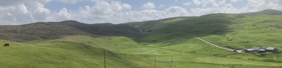
Shetland Pilgrim Way
These notes describe a multi-day journey along a continuous path from Sumburgh Head to the abandoned herring station at Fethaland Point, just north of North Roe. It takes you through the spectacular volcanic landscape of Northmavine. As far as possible the route avoids main roads and the start and finish points are accessible by public transport.
We hope later to provide information on a second route covering the North Isles as part of a Shetland St Magnus Way.
Stage 1: Sumburgh Head to Quendale
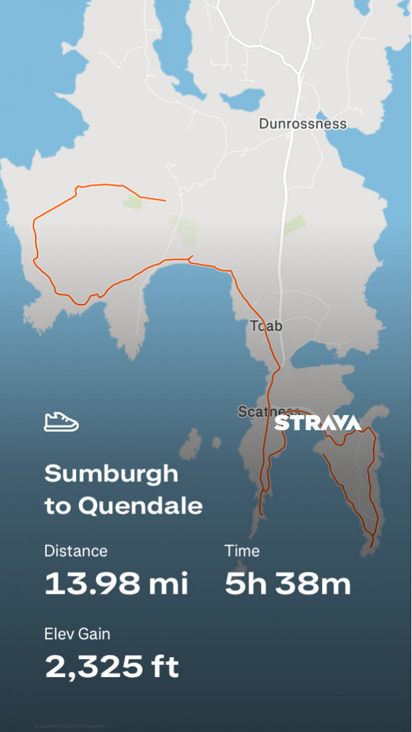
You can see an animated flyover of this route, superimposed on a 3D image of Shetland on the Strava website. GPX file below:
Start from the Sumburgh Hotel car park (bus route #6). Follow the signs for Jarlshof, one of the most significant archaeological sites in Shetland, but at the end of the path turn sharp left. The coastal path is signposted. Follow this to Sumburgh Head and when you reach the road turn right to visit the lighthouse. This is the southernmost point of the Shetland Mainland and Fair Isle is often visible in the distance. Return on the road towards the car park. You will pass a fibreglass model of an orca. A viewing platform just to the right of this (overlooking a geo) is often a good place to see puffins during the breeding season. Nearby you will also find a hide, provided by RSPB Scotland for viewing birds and whales. Cut the corner by going over the grass and follow the core access path which starts at the far end of the car park. Notice the World War II defensive structures - Sumburgh Head has been fortified since the Iron Age. The core access path follows the coast. There are panoramic views from Compass Head, on the highest ground to the left you will see the radar dome which marks the highest point of Fitful Head. On the right you can see the tall television antenna on the island of Bressay, just opposite Lerwick. When you reach a wall at the bottom, turn left and aim for the group of Victorian buildings on the road. You will come out by Grutness Pier, the ferry terminal for Fair Isle.
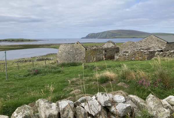
Old farm buildings on Scat Ness, looking towards Fitful Head.
Follow the main road for a short distance towards the Sumburgh Hotel. Just after the hotel entrance you will find a small access road. Take that, and after a few metres climb the bank and you will find a set of stairs leading down to West Voe beach. Walk on the beach to the far end. I took a path along the foreshore but it is rough-going and the land above is inaccessible because of walls and electric fences. You may prefer to exit the beach at the car park and take the road turning to Scat Ness on your left. There is another core access path here out to two excavated archaeological sites: the iron age block house and the promentary fort at Ness of Burgi. Neither is well signposted. Look for the metal cables which facilitate access to the fort over the rocks. Return on the road. On the right, just at the start of the Scatness houses, you will find a plaque commemorating the Italian POW camp which was here. At the main road (A970), turn left. Just before the airport you will find another major archaeological site at Old Scatness Broch. It is currently rarely open because of staffing issues but there was recently a proposal to make Jarlshof, Old Scatness and Mousa Broch a World Heritage site as being an exceptionally well-preserved prehistoric landscape. Obtain permission before crossing the airport runway. On the other side turn left to Toab. At the end of the road turn left. You will need to climb fences to gain access to Quendale Beach. Walk on the sands to the end. Just on the right before Quendale (the spur on the map trace) is a stream-bed which cuts the dunes. The first Dunrossness parish church was here before the sand encroached the site. It is visible as a low hill in a cow field. The medieval dedication was to the Holy Cross. At the end of the beach, climb up to the road, passing through the gate. You now have two options. You can turn right past Quendale Mill and pick up the bus (#7) from Hillwell which is the end of this day's journey. If you have the energy to climb Fitful Head you will be rewarded by some of the best views in the south Mainland.
To access the hill, turn left on leaving Quendale beach. Within a few metres you will find a farm gate on your right, set at right angles to the road. Climb over this and set a diagonal path up the hill, this will bring you over the ridge to some ruined crofts. Go past them and look for a bridge over the stream and then climb the gate beyond it. The next section is very steep. Keep on the landward side of the boundary fence. The gradient will gradually ease and the path swings round to the north west following the coast. A short distance before the radar dome on the highest point of the ridge, the fence turns at 90 degrees eastward. About 50 metres to the south of this turn you will find a notice commemorating a the crew of a Halifax bomber which crashed here in the second world war. Cross the fence and you will find a stone monument to those who lost their lives here. Return and continue on to the radar dome. Here you can admire fantastic views in all directions. It is possible to continue along the coast as far as Spiggie but the ground is rough and often waterlogged. Take the access road back to Quendale, cutting off the corner by heading north easterly down the hill. This is a gentle walk through farm fields and pasture, in great contrast to what you have just left behind. Continue to the Quendale road and turn left. There is a bus shelter at Hillwell at the junction with the Brake road. The service is infrequent but the #7 bus connects with the #6 in either direction.
Stage 2: Quendale to Bigton
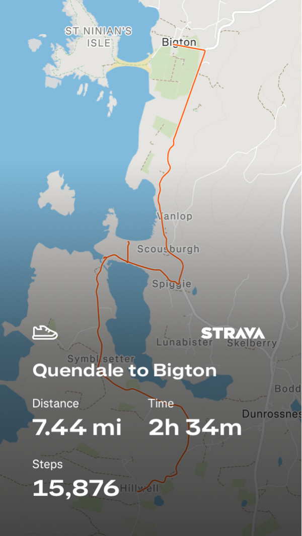
GPX file for route:
Start point: Quendale bus stop (Route #7, connecting with Route #6 at Channerwick Junction).
There is a track shown on the OS map, running north from Brake, which appears to join up with the Spiggie road. This was the old road leading to Quendale mill but is no longer open. An electric fence blocks progress just after the Burn of Hillwell. Instead take the minor road to Ringasta and turn left at the signpost for Spiggie. This is a scenic route through fertile agricultural land. It follows the west side of the Loch of Spiggie, an important bird reserve for fresh-water species. At the head of the loch (next to The Beach Bod) a gate on the left gives access to a small and attractive beach set between rocks.
There is an RSPB hide at the north end of the loch and the entrance to Scousburgh Sands is immediately opposite. The road continues to the junction with the B 9122 just after the Spiggie Hotel. Turn left. A layby on your left gives a good view of the beach at Rerwick, which is a good place to see seals, hauled up on the beach. Continue north for a few metres and you will find a stile giving closer access.
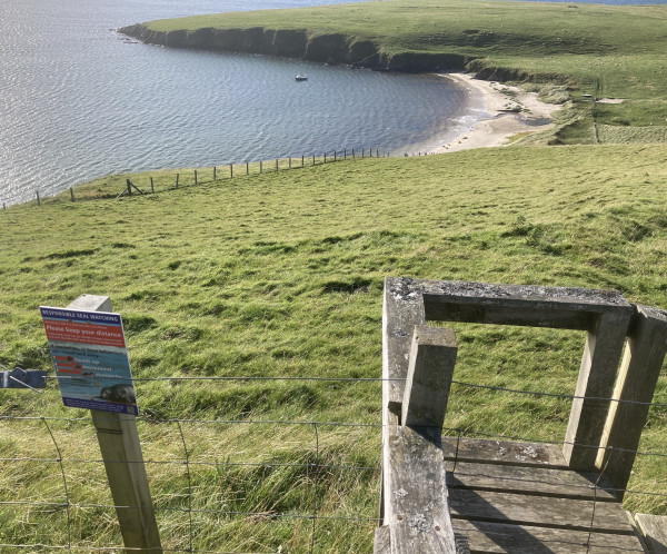
Notice encouraging "Responsible Seal Watching" at Rerwick.
Continue on the B 1922 until the Bigton junction and then turn left. The bus stop (Route #7) is opposite the community shop. You can connect at Channerwick Junction with the #6 bus (Lerwick - Sumburgh).
Stage 3: Bigton to Sandwick
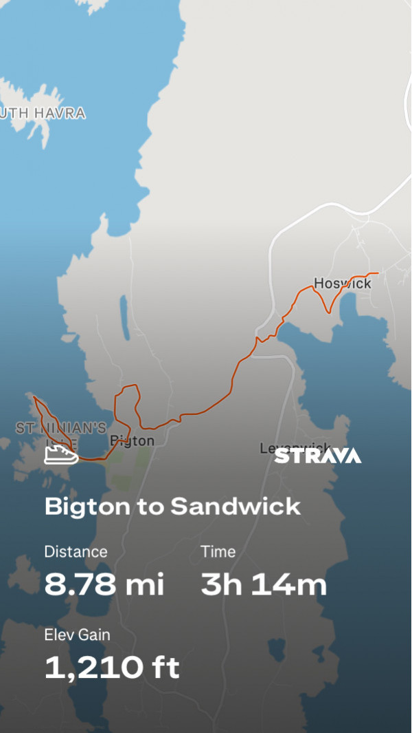
GPX file for route:
Start point: Bigton, Bus Route #7, connecting with Route #6 at Channerwick Junction.
From Bigton, follow signs to the beach and cross the tombolo to the end. Look for a section of dry-stone walling above you in the dunes on the right hand side. There is a path here which will take you to the top. Turn right and enter the fenced enclosure. Here are the ruins of St Ninian's Isle Chapel, one of the oldest Christian sites in Shetland. The present building is probably from the 12th century but sits on earlier walls (one section is below the grill in the chapel). The uprights stone marks the find site of the St Ninian's Isle treasure, buried here c. 800 AD, probably in connection with Viking raids.
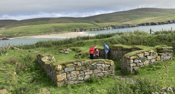
From the chapel enclosure follow the coast in an anti-clockwise direction as far as the Ordnance Survey trig point. This is the highest point of the island. If you look south you will see Fitful Head and the route you have covered from Sumburgh. To the north you have the sea route to Burra Isle, where there was a Pictish monastery at Papil contemporary with the original St Ninian's Isle chapel. These sites were founded by Celtic monks in the 8th century. There is an access route right around the island with fine cliff scenery, otherwise you can cut back across the island to the chapel site and retrace your steps to Bigton. When you reach the village turn left on the road and after about 50 metres, when the road turns sharply to the right, go straight ahead on a minor road passing the children's play park. At the end it meets a farm track at a T-junction. Turn left down towards the sea and when you reach the coast leave the track and walk on the pebble shore of Ireland Wick. Near the end you will find access to the road leading to the cemetery. Climb the road to Ireland village and turn right at the top. Almost immediately you will come to two white houses on either side of the road: Steeple Cottage and Ringan. This is Steeple Green and near here was the medieval church of St Mary, one of the three towered churches built in the 12th century by three Norwegian sisters. Nothing remains of it now, Follow the road back towards Bigton village, it comes out by the old St Ninian's Church, now converted to a community owned centre called Hymhus. Turn left up to the B 9172 and follow this to Channerwick junction. At the junction with the A 970, turn left for about 100 metres and then take the right hand turning leading to Brune. This descends steeply towards Channer Wick. The road leads to a ford, it is easier to cross a little further to your right. A gate gives access to the shingle beach. Turn left. Just before the burn you will find traces of an Iron Age broch which is gradually being eroded and was recently excavated. At the burn go upstream slightly to a small bridge. This will bring you out at a stile over a fence. Cross this and aim for the white croft with the green container-shed. Here you can get to access to the Rompa road. Climb this. Just before the summit, when you reach a domestic wind generator, take the farm track on the right. This gives fine views over Hoswick and Sandwick. It comes down in the village. There is a popular cafe at the Hoswick Visitors Centre and a couple of Shetland knitwear shops. When you reach the Sandwick road, turn right. The bus stop is just opposite the Sandwick Bakery / Spar supermarket. (Route #6).
EARLIER ROUTE
Day 3: Sandwick to Quarff.
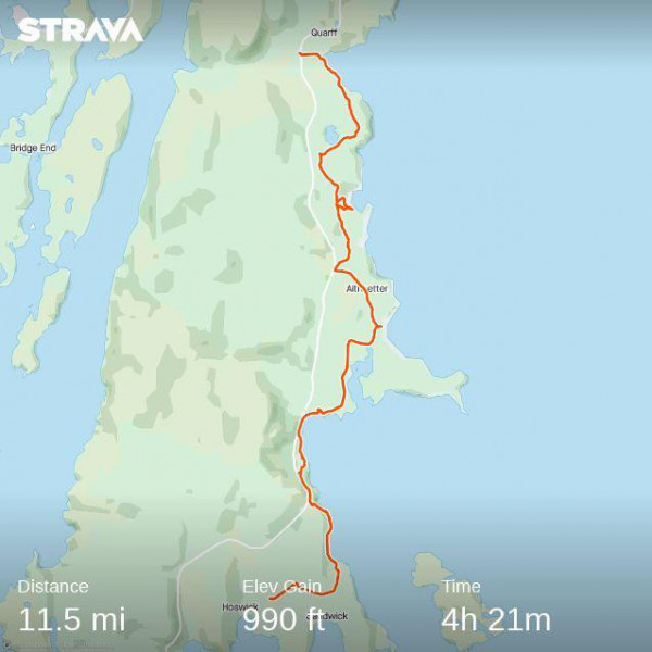
Start Point: Sandwick Bakery (Bus route #6)
From the bakery, set off in the direction of Lerwick. Take the second turning on your right and follow the minor road to Sand Lodge, a fine old house where there once a copper mine. From here you have over to the island of Moussa, which has the best preserved broch in Scotland. It was built about 2,000 years ago and still stands to roof height. It features in one of the Norwegian sagas. A private ferry will take you over to the island, boats go from the pier near Sand House. From the pier take the minor road uphill in the Lerwick direction. After about 200 metres you will see a footpath signposted on your right, this follows the edge of the coast and can be followed most of the way to Mail, although the second part is hard going. You may prefer to climb up to the A 970, where there is an access point to the layby provided as a viewpoint for Mousa. The last section needs to be on the hard shoulder of the A 970. At the end of the bay, turn right to Mail cemetery. A Pictish sculpted stone was recently found here and this may be the centre of what later became Cunningsburgh, a name derived from the Norse for "King's Fort". You can avoid a long section of the main road by using the network of minor roads through North Voxter, Aith, Aithsetter, Orcaquoy and Fladdabister. It is worth stopping at Fladdabister. This has many abandoned crofts from the 17th and 18th century and gives a good impression of what Shetland would have been like in more rural days. There are interpretative boards with photographs from the 1930s when many of the buildings were still occupied. An access path on the right leads to the old lime kilns on the edge of the Bay of Fladdabister. Much of the mortar used in the construction of the older buildings of Shetland was produced here.
Continue on this minor road towards the A 970, but before reaching the main road, take the track on your right which leads to Loch of Fladdabister. This is rough ground but it is possible to gain the coast by going cross-country and come out at Casho (East Voe of Quarff). When you reach the houses take the access road past the rapidly-decaying Quarff Kirk to the bus stop at the southern Quarff junction. From here you can get a bus on route #6.
Day 4: Quarff - East Voe (Scalloway)
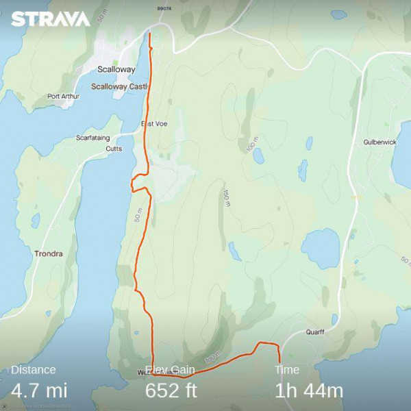
Start point: Quarff junction, bus route #6.
From the Quarff bus stop, take the minor road to Wester Quarff. When you reach the houses take the track on the right (marked on the OS map) which follows the crest of the ridge. From here you have amazing views over the islands of Tondra and Burra, with Foula on the horizon. The last section of the path hits some stony ground where a burn comes down to the sea. It is a nesting ground for birds and when I last did the journey I was dive-bombed by artic terns. It is good to hold something over your head to keep them off. The owner of the farm at Uradale is a pioneer of sustainable farming methods. Near the farm you can join the road and pick up the #4 bus at East Voe or turn left at the main road and get the bus from Scalloway. The 16th century castle is currently under restoration and is closed to visitors but the museum is well worth visiting and has much material relating to the Norwegian Resistance movement during the Second World War. There is a monument to the Norwegian sailors who lost their lives in the "Shetland Bus" operation on the sea front, just opposite the Kirk. Scalloway was the ancient Norse capital of Shetland and has many old buildings of interest. The University of the Highlands and Islands has its campus at Port Arthur, last stop on the #4 bus route.
Day 5: Papil, Burra Isle, to Lerwick
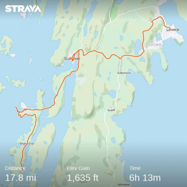
Start Point: Papil Kirkyard (Bus route #7, connecting with #4 at East Voe (Blydoit) or Scalloway Hall).
The map for the next two days shows a cross route linking Burra Isle and Bressay. It intersects with the end point of Day 4 at East Voe.
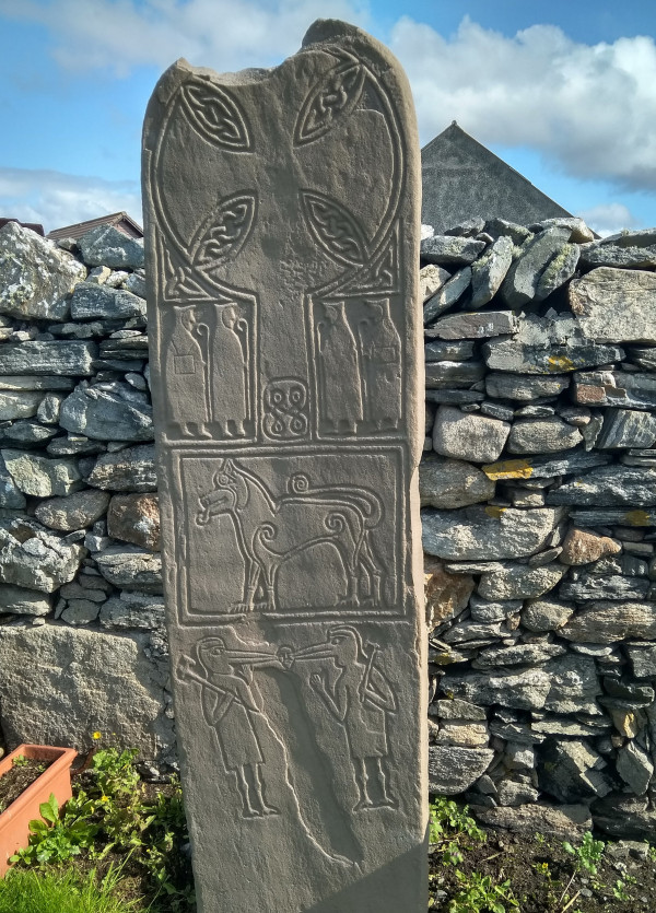
The two islands of Tondra and Burra have been linked to Mainland by bridges and no ferries are required to reach them. This is already a long section, but if you don't mind adding a couple of kilometres to the journey, ask the bus driver to drop you at the Croft museum. From here it is just a short distance to Banna Minn beach. The cemetery at Papil is on the site of one of the most important early Christian sites in Shetland. A Pictish monastery was founded here in the 8th Century. The first missionaries to Shetland were probably Celtic monks belonging to the spiritual family of St Columba of Iona but Pictland (to which Shetland then belonged) later came within the spiritual sphere of Northumbria. Two sculpted stones, showing the hooded figures of monks, have been recovered from the cemetery.
Follow the minor road north to the junction just beyond Bridge End and then turn left towards Hamnavoe. When you reach a car park on your right (with public toilets), take the board walk on your left which leads to Meal Beach. Walk over the sands to the far end and follow the coast to the lighthouse at Fugla Ness. The last section is very rocky but worth the effort. Return and join the road (B 9074) at Hamnavoe and continue on this road over the two bridges back to East Voe. From here you have two options. The route shown on the map followed the road (A 970 then B 9073) to Lerwick. Most of it is on a fairly busy road but it has a few places of interest along the way. "Hollanders Knowe" is where Dutch traders used to set up their stall before Lerwick developed as a town in the 18th century in response to growing trading links with the Low Countries across the North Sea. At Upper Sound, just before entering Lerwick on the A 970, you pass the old Observatory on your right. These buildings began as a naval wireless station just before the First World War but later became a Geophysical Observatory linked to the Met Office. Most of this complex has been redeveloped as social housing but the string of huts along the crest of the hill leading to the Ness of Trebister still house instruments measuring variations in the earth's magnetic field. You can continue on the main road to the centre of Lerwick or take the turning on the left just after the Observatory to Sandy Loch reservoir (the main water supply for Lerwick). The tracks will bring you out on the old North Road, and so into Lerwick centre.
My preferred route would be to continue north through the Tingwall valley. From East Voe (the end point of Day 4), continue north to the junction with the main Scalloway road, turn right and then almost immediately left by the fire station. Continue on this path past the golf course club house at Asta Loch. On your right, by the roadside, you will find a standing stone commemorating a medieval battle. There is an access path near this point which allows you to walk along the eastern shore of the Loch of Tingwall, or you can continue on the road to the northern end of the loch where a display board tells the story of Law Ting Holm, which was the location of the Shetland 'parliament' until the 17th century. Dominating the head of the valley is Tingwall Kirk. The present building (recently closed for worship) is from the late 18th century but stands near the old medieval church of St Magnus (another of the three Steeple Kirks already encountered at Ireland and Papil). This was the principal church in Shetland in the middle ages. Tingwall had an association with St Magnus of Orkney back to the time of the sagas. The cathedral in Kirkwall was built to house his relics and Shetlanders from this area went ther on pilgrimage. There is a burial vault in the grave yard containing early grave stones. It may be a fragment of the old medieval church structure. Continue northwards to Tingwall Crossroads by the hotel. There is a bus top here from where you can get the #21 bus to Lerwick. We pass this point again on Day 7.
Day 6: Bressay and Noss
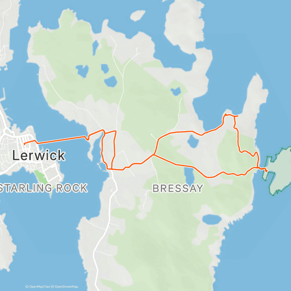
Start Point: Bressay Ferry Terminal (near the Viking Bus Station, Lerwick).
The crossings to Bressay are roughly every half hour. Bressayu Sound is one of the best natural harbours in Europe, the present Lerwick port stretches two miles up the coast with different sections for yachts and pleasure boats, cruise ships, the Aberdeen ferry, fishing boats, and oil support vessels. At the peak of the herring boom Lerwick harbour could accommodate 1,000 boats before they went out to the fishing fields. Lerwick is still one of the most important ports for the UK fishing industry and your visit may sometimes be accompanied by the pungent smell of the gutting factory on Bressay.
From the ferry port, turn right and pass right through the village. If you have plenty of time for the excursion, continue south to the iconic Sumburgh Lighthouse at Kirkabister Ness. There is an access path from here that goes round the southern half of the island. Otherwise, turn east when you reach the shop and follow the signs to Noss. After about 2 km there is a turning on the left to Setter, follow this to the end. Just before reaching Setter farmhouse there is a track on the right which leads to the ruins of St Mary's Church, Cullingsburgh (the north loop on the map). There was an early Christian church here and in the graveyard you will find a replica of the Bressay Stone found nearby. It dates from the 9th century and blends Pictish and Scandinavian styles. The ruins belong to the medieval Catholic church. In one corner of the church yard you will find the remains of a prehistoric broch. The bay is a good place for lunch. There are often seals there.
From the cemetery climb the hill to the south of you to the tower on the summit. This is an old Admiralty watchtower from the First World War and you have an excellent view here over the island of Noss. Continue down in the same direction you came. It will bring you out at a car park with information boards. From here a track leads to a ferry - a rubber dinghy - which crosses in the summer season to Noss. The whole island is a bird reserve. Archaeologists recently excavated a small Pictish church on the island which yielded "shrine posts" like those found on St Ninian's Isle. This may be linked to the place name "Papil Geo" on the north coast of Ness. Many of the Papa and Papil names in Shetland indicate early Christian sites. The Lerwick Museum has a good collection of early Christian material. You will notice the high quality of the dry stone walls on Bressay. In the 19th century the Earl of Caernavon had an estate on the island to breed Shetland ponies, valued for work in the coal mines of Wales because of their small size.
Return to the ferry on the Noss road back to the village (the south loop on the map) and so return to Lerwick. If you would like a break from walking at this stage you could book one of the tourist boats from Victoria Pier which go round the islands and allow you to see the nesting birds on the cliff face from a good vantage point.
Day 7: Lerwick to Bixter.
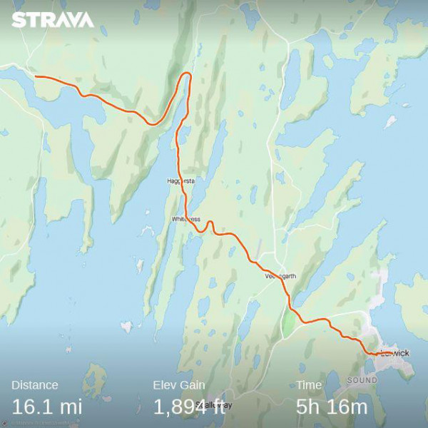
Start Point: Lerwick centre.
Head out of town in a westward direction. Just to the right of new Anderson High School (next to Clickimin Loch) you will find a cycle path which runs diagonally up Staney Hill. At the top, continue to the junction with the old North Road and turn left. The road will take you past the Lerwick Brewery and Agricultural College. Stay on this road to the junction with the A 970 and then turn left. After the first turning to the right (Viking Energy) you will find a lay-by, at the end of which is a gate leading to a track running parallel to the Burn of Frakafield. Follow that track and do your best to get round the new industrial works connected with the wind farm. It is still possible to come down into the golf course. Keep this to your left and make for two ruined crofts on the other side of the valley. This is now a restricted area but you can scramble up the hillside to join the main road (A 970). After about 500 metres on the main road, turn left to Veensgarth, past the hotel. This leads you to Tingwall Crossroads which was your end point if you took the alternative Tingwall Valley route on Day 5. Continue on to the end, when you will reach the Walls road by the entrance to Tingwall airport. This airstrip is only used for inter-island flights to Foula and Fair Isle and medical flights to Aberdeen.
The rest of this day's journey is on the A 971 to Bixter. The nature of the ground makes it difficult to get off the road but there are some fine panoramic views over the islands. Just bejond Kalliness you will pass the workshops of Shetland Jewellery. This valley is Weisdale, one of the areas most badly affected by the clearances in the early 19th century when crofters were driven off their land by landlords to make way for more profitable flocks of sheep. At the head of Weisdale Voe the main road (A 971) does a u-turn up the opposing side of the valley. A short detour northwards from the beginning of this curve (B 9075) will take you to the recently closed Weisdale Kirk, a fine building set in a well-managed garden, then Weisdale Mill which has been restored as the Bonhoga Gallery. On the opposite side of the road is the Hatchery Bookshop, Shetland's only second hand bookseller. Roughly two kilometres to the north of the junction is some 19th century woodland surrounding Kergord House. This was the second centre for the Norwegian Resistance movement in World War II. Continue northwards and you will find yourself in the unlovely industrial landscape of the Viking Wind Farm. Return to junction with the A 971 and turn right. Continue on this road until you reach Bixter. Here you can get a bus back to Lerwick. (Bus route #9)
Alternative route: If you took the second option on Day 5, start from Tingwall Crossroads bus stop (bus route #21) travel north west on the minor road to join the A 971 at Tingwall Airport and turn left. Continue on this road to the head of Weisdale Voe but at the u-turn take the minor road signposted for Cott running along the west bank of Weisdale Voe. Roughly on line with the westward turn of the A 971 above you there is a lay-by and on the right a gate leading to a small grave yard. This is the site of the old medieval chapel of Our Lady of Weisdale, which remained a place of pilgrimage after the reformation. It is difficult to recognise any medieval work in the burial enclosures now occupying the burial ground. Return to the minor road and continue towards Cott. Shortly before the last houses a farm gate on your right gives access to Russaness Hill. Climb this in a south westerly direction, keeping the summit of the hill to your right. From the crest of the ridge you have good views over Sandsound Voe and beyond that Sand Voe. In the days when Shetland was a centre of the whaling industry, whales were driven up Sand Voe to their death. A ruined chapel at the head of Sand Voe is linked, in local tradition, to survivors of the Spanish Armada. It is not accessible from this side of Sandsound Voe. Continue down the far side of the hill, join the road at Sandsound and follow the road until it meets the A 971 near Tresta. Turn left on the main road until you reach Bixter bus stop. (Bus route #9).
Day 8: Bixter to Brae
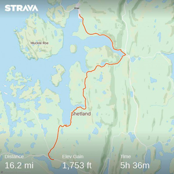
Start point: Bixter Bus stop (bus route #9)
.From Bixter, turn westwards towards Walls. After about 500 metres turn right on the B 9071, continue on this to Aith. Just before you reach the village there is a recently planted plot of woodland called "Michael's Wood" which has been set up with children in mind. It is open to the public (free). Aith has a Marina and shop (Eid Co-op). Continue northwards until the road curves at the head of East Burra Firth. There is parking here because of a popular short walking path beside the Burn of Linklet. In this area you will also pass the "Original Cake Fridge" and cafe. The next section of the road is locally known as "The Alps". The road is hilly and winding. It leads finally to Voe. After the pier, take the footpath which follows the north coast of Olna Firth. It will bring you to the ruins of an 18th century Presbyterian chapel and grave yard. The walls are in a dangerous state and part recently collapsed. From the cemetery you can follow the access road to join the A 970. Turn left towards Brae. For at least part of the way it is possible to walk a little down from the road on the shore. The bus stop is opposite Brae Hall. You are now in the North Mainland. Brae has a fair size Co-op and the award winning Frankie's Fish and Chips shop (Bus routes #21 and #23).
Day 9: Brae to Urafirth
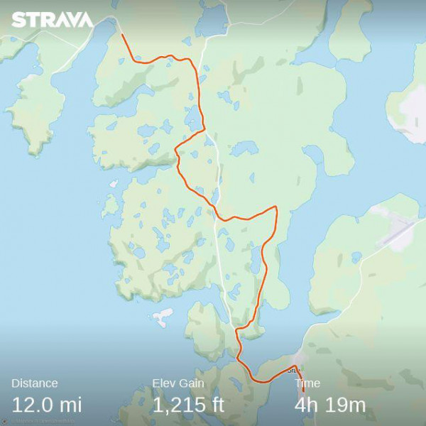
Starting point: Brae Hall, Bus routes #21 & #23.
Head north through the prosperous village of Brae, built in response to the oil boom of the 1970s and 80s. The road turns sharply left just before the Co-op. After about 1 km there is a turning on the left to Muckle Roe. It is worth making a small detour to view Busta House Hotel, one of the most imposing old houses in Shetland. Otherwise continue to Mavis Grind. This is the narrowest point of Mainland and the saying is that from here you can throw a stone into the North Sea, then turn round and throw another into the Atlantic. Into comparatively recent times fishermen used to haul their boats over the isthmus to avoid the long detour round Yell Sound. Presumably it has always been so and there are a number of prehistoric sites around the sheltered waters of the voe to the west. A short detour along the north shore will take you to an excavated chambered cairn down by the shore. Notice also the display by the roadside of the different rocks to be found in Northmavine. This is a volcanic area and much of the stone is red igneous rocks but the display points out the incredible complexity of Shetland's geology. The whole archipelago is designated a Geopark.
.After about 500 metres on the main road turn right to Sullom. From this road you will have good views over to Sullom Voe Terminal, the original landing point of much of the oil from the North Sea rigs. From here it was conveyed by tankers around the world. Now, most of the remaining oil is piped directly to the Scottish Mainland and Sullom Voe is coming to the end of its working life.
When you reach the T-junction turn left, back to the A 970 and cross over to the minor road to Gunnister. Near the junction you will find a monument to "Gunnister Man", a young man from Holland whose body was found in the peat near here. He was perhaps buried where he was found dead and the special qualities of the peat had preserved his woolen clothing. Coins in his purse indicate a late 17th century date. A reconstruction of his original appearance can be seen on display in the Lerwick Museum. At Gunnister, cross the valley through the open fields and join the road on the other side at Enisfirth. This will bring you back to the A 970. Continue on to Urafirth bus stop, from where you can get a bus back to Lerwick (bus route #21).
Day 10: Urafirth to North Roe and Fethaland Point
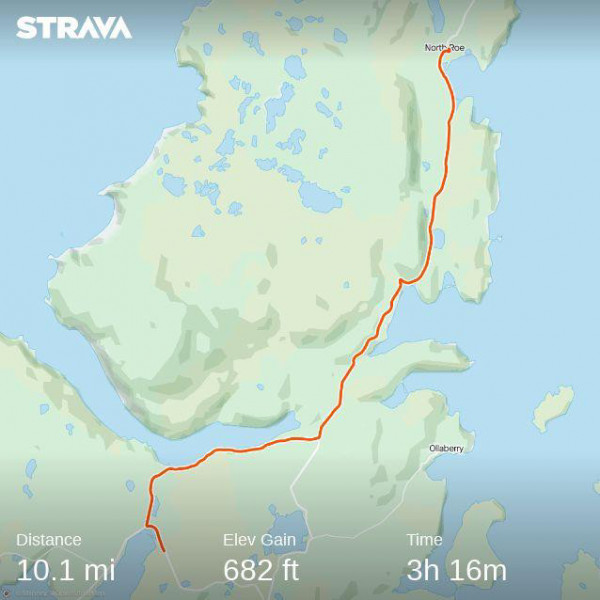
When I walked the route recorded by the Strava map traces I was pressing northwards, but for a Shetland Pilgrim Way I would add a day here, perhaps ending Day 9 a few kilometres further on at Hillswick where there is accommodation at the St Magnus Hotel. This hotel has a long history and once belonged to the North of Scotland Steamship Company. Passengers could board at Leith (Edinburgh) and be landed in Hillswick Bay for a remote holiday. 20th century guests included Christopher Isherwood, W.H. Auden and Margaret Thatcher. The wooden hotel was constructed in Norway, exhibited in Glasgow, and then reassembled in Shetland about 150 years ago. There is an access path around Ness of Hillswick, with dramatic views over to Eshaness, but most visitors take the B 9078 to Braewick (Cafe and Wigwam accommodation available). From the car park you have a view over to the Drongs, needle-like stacks just off shore. Continue westward (with an optional detour to Tangwick Ha' Museum on the coast), from this stretch of the road you have clear views of the off-shore natural rock arch known as Dore Holm. The shape is reminiscent of a horse dipping its head in the water to drink. Take the turning on the right marked Eshaness Lighthouse. Before reaching the lighthouse turn left to the cemetery. Here are the ruins of a medieval church dedicated to the Holy Cross. Notice the table tomb with a vitriolic inscription against a chemist who killed the patient by accidentally issuing saltpetre in place of Epsom Salts, and the grave of "Johnnie Notions", a 19th century Shetland doctor who pioneered vaccination against small-pox. There is parking available at the lighthouse and access paths in either direction along the coast. This is the most dramatic cliff scenery in Shetland.
Starting point: Urafirth Bus stop, route #21.
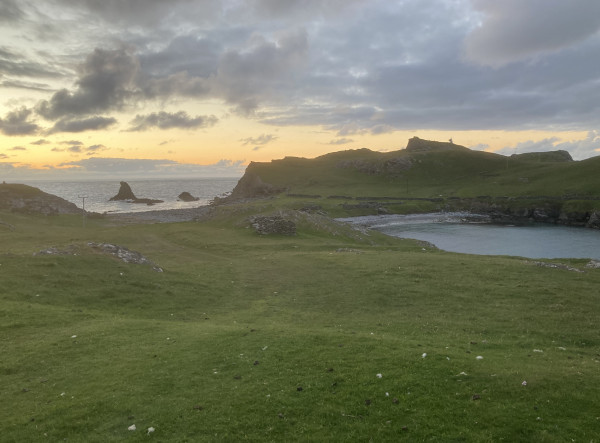
For the route indicated on the Strava map above, set off from Urafirth towards Hillswick. Take the second turning on the right (signposted to Heylor) and at the fork in the road turn right. From here you are directly facing Ronas Hill, the highest point in Shetland (summit 450 metres above sea level). It is the denuded magma chamber of an extinct volcano. Continue eastwards until you reach the A 970 by Swinister and continue northwards on the main road to North Collafirth. If you wanted to climb Ronas Hill, this is the easiest access route. Follow the track to the antennae on Collafirth Hill. There are the remains of a neolithic axe factory near the spring wells marked on the OS map and other prehistoric monuments by the roadside near Loch of Housetter. Follow the road through North Roe to its terminus at Isbister and then take the coastal access path indicated to the right. This will take you to the Kame of Isbister, which has sometimes been interpreted as an early Christian monastic settlement. More recent work has thrown up the alternative view that this is a Viking age military post, paired with a similar site at Birrier immediately to the east on the Yell shore. The access path allows you to reach the Point of Fethaland where there are suggestive remains of a 19th century herring station. This is the northernmost point of Mainland. Look north eastward and you will see the alignment of two headlands, Gloup on Yell and Muckle Flugga, the northernmost point of Unst.
Ambrose Flavell. 10th August 2026
Welcome

Welcome to shetlandpilgrimage.scot.

Links: Shetland Churches
- Catholic Church, Shetland.
- Episcopal Churches in Shetland.
- Methodist Churches in Shetland.
- Orthodox Community of St Ninian, Shetland.
- Shetland Church of Scotland.
Shetland
- Shetland Retreat, Fetlar.
- Papa Stour Community History Group.
- Hamars & Harps, Haroldswick, Unst.
- Wild Skies, Shetland.
- Fair Isle Bird Observatory.